
It was a volatile overnight session for natural gas prices, as some warmer risks in the medium-term on European guidance sent prices lower. They were able to quickly V-bottom off cold risks at the end of the run, however, and prices continued to rally through the day today.
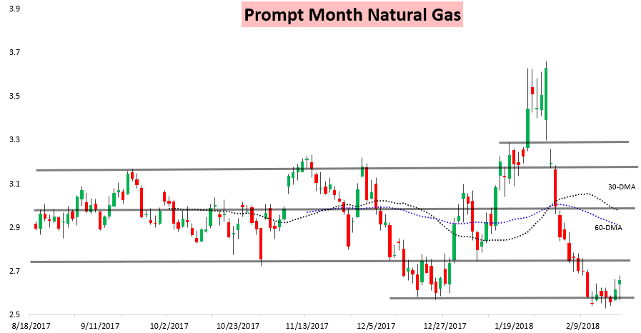
As would be expected with this weather-driven rally gains were most significant at the front of the strip, even as front contracts again pulled back a bit into the settle.

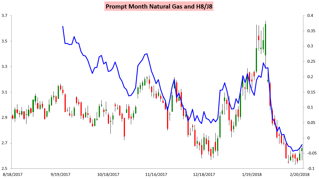
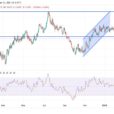
This has helped the March/April H/J spread recover slightly, moving 2.1 cents off its lows from last week.
The overnight dip in prices was impressive but did not surprise, as we had been watching for model volatility and increased price sensitivity to weather. Our Note of the Day to clients yesterday focused on expected short-term model volatility and how to potentially position for it, and prices today moved within 2 cents of the short-term range we had been watching for.
These colder forecasts in early March have been driven by a very significant stratospheric warming event, where the stratospheric vortex over the North Pole was perturbed and eventually split. The result was that stratospheric temperatures across the northernmost portions of the Northern Hemisphere rose dramatically and have recently set new records for the time of year, as seen below per NOAA.

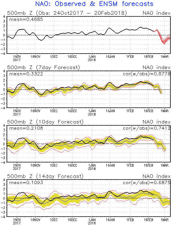
The relevant downstream impact for the United States is an expected drop in the North Atlantic Oscillation, as seen on yesterday’s run of the GFS ensembles per the Climate Prediction Center.
The below Climate Prediction Center graphic shows more precisely what is expected to occur. A typical “Positive NAO” pattern in January features a large upper-level low-pressure system across southern Greenland with resulting higher heights from the Eastern United States across the Atlantic Ocean into Europe, favoring warmth across the region with a strong, active jet. In a “Negative NAO” the pattern holds the opposite; a large upper-level high-pressure center builds in across Greenland, sometimes referred to a “block” as it blocks the jet stream and directs colder air down and around it. As a result of this block, Europe has recently turned far colder, and the United States looks to follow into early March.


Leave A Comment