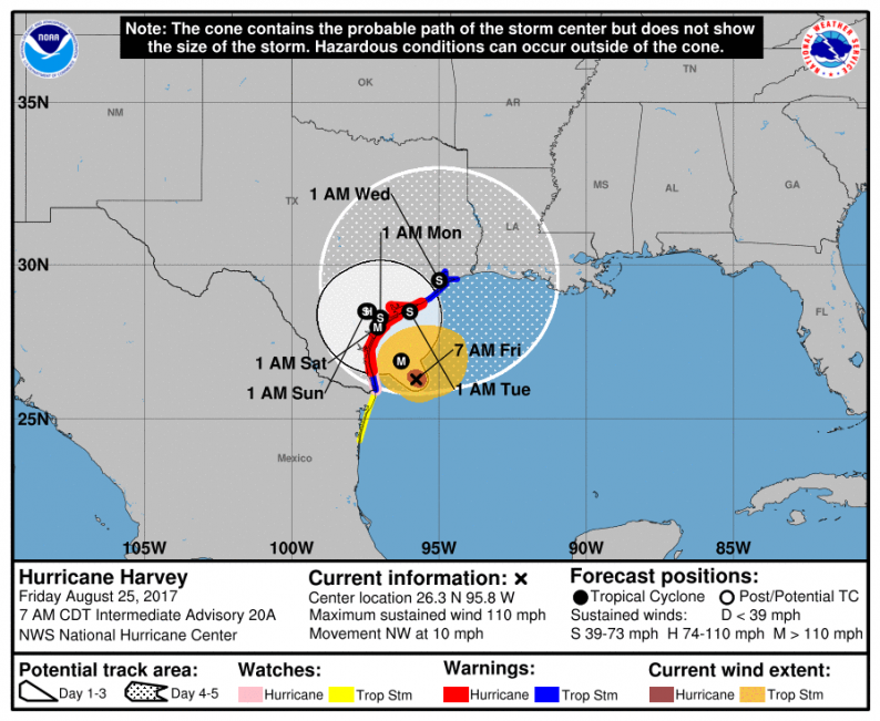
Forecasts overnight did not shift significantly for Harvey, which continues to progress right at the Texas coastline. Landfall near Corpus Christie looks the most likely, though impacts will obviously be far more widespread. The latest National Hurricane Center forecast has Harvey make landfall as a strong Category 3 hurricane with sustained winds of 120 mph. There is even a risk it briefly achieves Category 4 status. From there it is likely to stall along the Texas coastline and gradually weaken while over land, though it will continuously batter the region with dangerous winds and torrential rain.
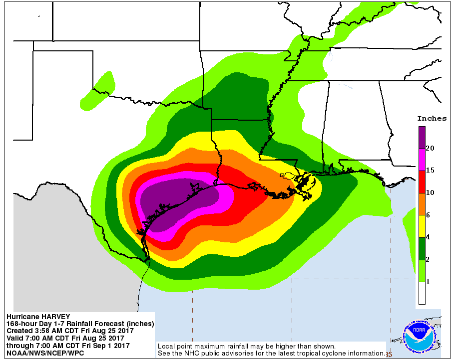
With the storm forecast to stall through the weekend, the latest rainfall forecasts from NOAA are simply incredible, as they are now calling for widespread rainfall accumulations of 20+ inches through the end of next week. Isolated amounts up to 36 inches are not out of the question.
Confidence at this stage is quite high on where the impacts will be most severe over the weekend as the storm approaches land tonight, especially as once over land it does not look to move all that much. Where confidence falls off, however, is in forecasts of what Harvey does next. Though it looks to stall just inland over the weekend, early next week some models show the storm re-emerging out over the Gulf of Mexico (model tracks below courtesy of Tropical Tidbits).

With the Gulf remaining so favorable for tropical storm development, we could actually see Harvey re-strengthen early next week should it move back over water. A couple models are already beginning to show this in the 60-96 hour range, though again confidence here is lower with the consensus not as strong (below image also courtesy of Tropical Tidbits).
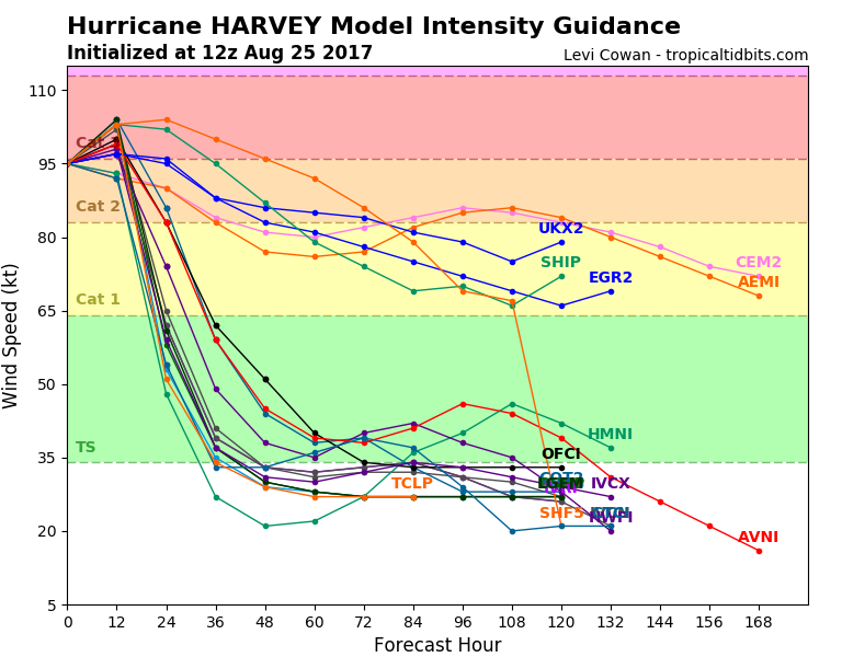
A number of global operational models that we tend to use for these forecasts are showing this re-strengthening trend, though, and the impacts of this could be significant. A second landfall could occur around Houston or even further east, where there is even more energy infrastructure (both over land and offshore). Re-strengthening would allow both for even more rainfall and a potentially larger swath of wind damages, ensuring that damages are longer-lasting as repair crews will have to wait even longer to begin work.


Leave A Comment