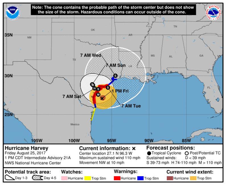
As we head into the weekend and energy traders place their final bets, the latest weather models are showing a couple trends that indicate some energy infrastructure may be spared the worst of Harvey. Though the imminent landfall and impacts over the next couple of days remain high confidence, we see confidence fall off rapidly by the start of next week. Harvey is expected to stall and generally linger in the area, but as the 5-day National Hurricane Center forecast shows, exactly where Harvey stalls and then where it slowly wanders to over the next few days is less clear.
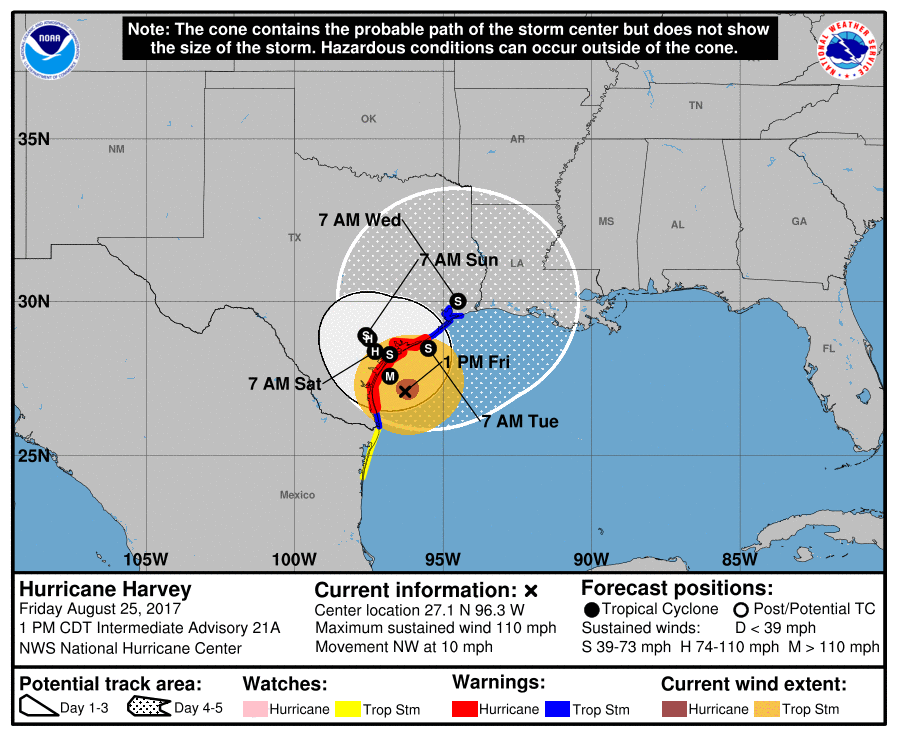
A gradual trend to the north and east is expected, but the cone widens rapidly as it becomes unclear whether inland Texas or coastal Louisiana is most at risk. With so much energy infrastructure around coastal Louisiana, traders have been monitoring this very closely through the day. We noticed in the most recent batch of afternoon weather models that there was a slight track to the west, meaning that a re-emergence of Harvey over the Gulf of Mexico or a direct hit of coastal Louisiana appears a bit less likely. This is seen on the latest model spaghetti chart below, courtesy of Tropical Tidbits.
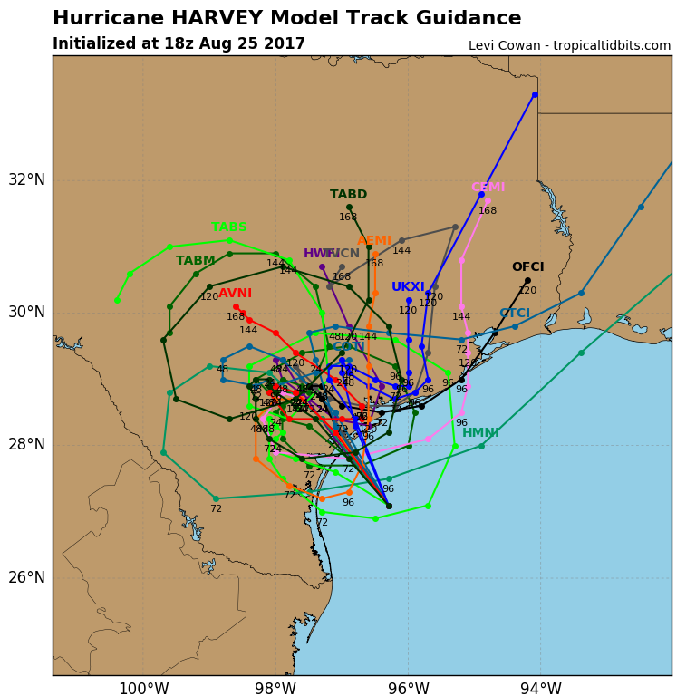
As a result of the storm seeming more likely to stay on land, fewer models are forecasting the storm to re-strengthen early next week (below image again courtesy of Tropical Tidbits).
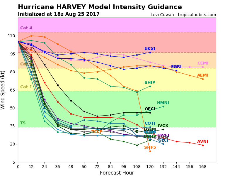
There are two important caveats here. The first is that this is just a recent trend with the latest suite of guidance. It is far from the final outcome, and through the weekend we will likely see guidance swing back and forth. All this indicates is that a re-emergence and direct impact to coastal Louisiana is now a bit less likely than it was this morning, with less risk being posed to those rigs/wells offshore.
The second is that for much of Texas, the difference between Harvey re-emerging and moving east and just meandering a bit further west and stalling is rather minimal. It will still be devastating tonight as it makes landfall, and severe flooding can still be expected across much of Texas. The below forecast from NOAA for total rainfall thus still holds, and those in the path of this storm hopefully have already completed preparations.


Leave A Comment