
Weather continues to push around natural gas at will, with far warmer overnight weather models pushing prices far lower before colder afternoon model guidance shot prices back up to new highs.
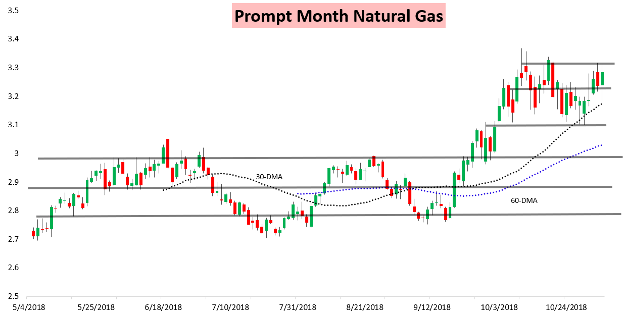
Weather was clearly the primary reason for the spike with the front of the strip making the largest gain on the day.
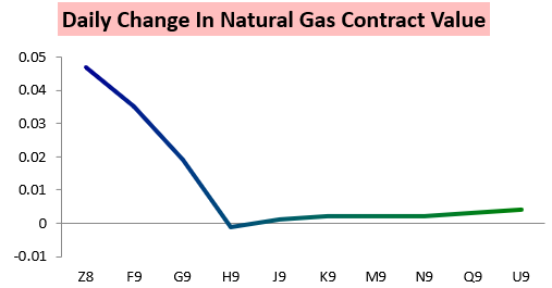
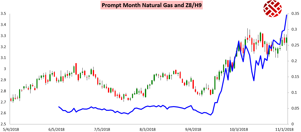
The result was another significant spike in the Z/H December/March contract spread.
Prices initially were off significantly this morning as we noted a solid dip in GWDDs in the medium and long-range in overnight forecasts.
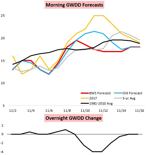
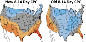
The Climate Prediction Center noted these trends in the 8-14 Day outlook today, which warmed but did not take into account all of the colder afternoon model guidance.
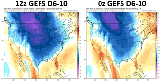
Afternoon GEFS weather model guidance trended significantly colder to start things off, sending prices soaring with a significant medium-range cold shot (model images courtesy of Tropical Tidbits).
Headed into the weekend, traders were forced to decide whether these trends would hold or intensify, with clear volatility across weather models.


Leave A Comment