
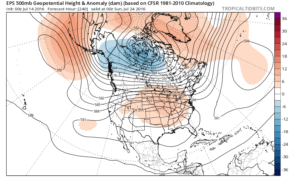
While expectations of major heat across the center of the country continue to generate headlines, an aspect of the story may be missing: exactly when that heat is expected to abate. That is due to relatively widespread uncertainty with regards to the exact timing and movement of any ridging across the center of the country. Models agree through Day 9 that strong ridging remains across the center of the country is strong. The ECMWF ensembles for late Saturday July 23rd can be seen below with a strong “heat dome” over the center of the country (image courtesy of Tropical Tidbits).
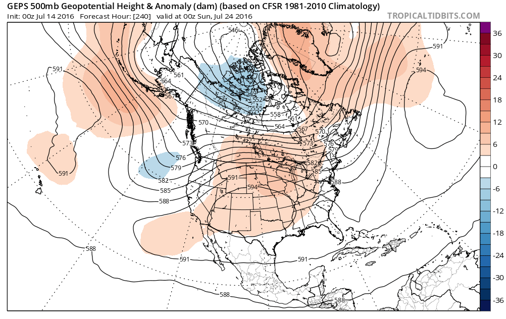
Below we show the Canadian GEPS ensembles for the same time.
And below are the American GFS ensembles for the same time.
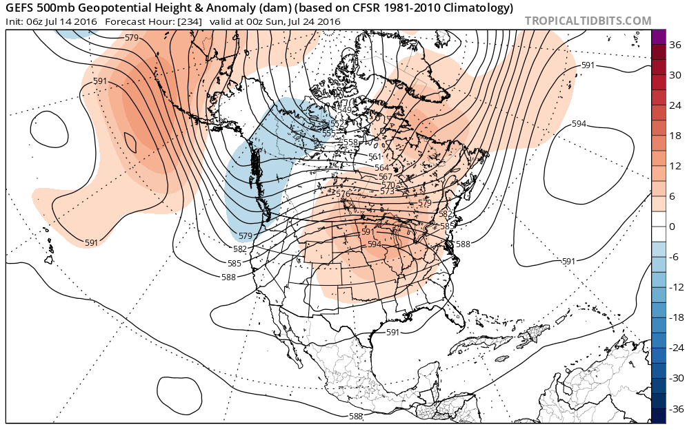
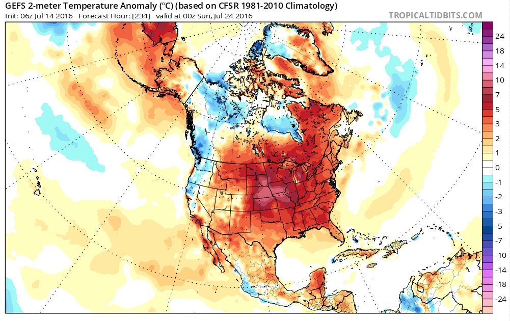
The agreement is relatively strong in this timeframe, and thus confidence is high in widespread warmth focused in the center of the country. There are minor differences over exactly wear the strongest ridging and where this “dome” of heat will set up, but broadly the center of the country is targeted. Taking a look at the surface, on the GFS ensembles, we see almost all of the country is expected to have temperatures above average with the heat strongest over Nebraska/Iowa and the surrounding Plains Day 9.
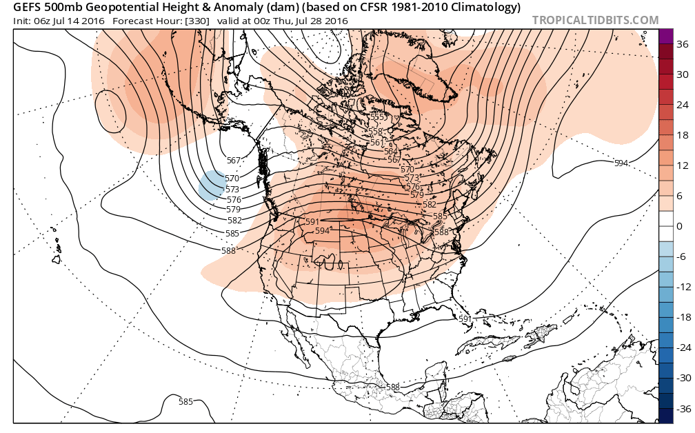
The question then becomes: when does this heat break down? That is where the model agreement begins to ease. The American GFS ensembles show ridging begin moving slightly off to the west by early on July 28th, allowing slightly more cool weather to move down into the East Coast but keeping much of the center of the country hot.
The GEPS Canadian ensembles, meanwhile, do not have remaining ridging nearly as strong, and show more of a trough across the East that would keep temperatures even more seasonable, as seen below.


Leave A Comment